JULY 1, 2018
– Greg Snow
The US Army Corps of Engineers (USACE) has released the May 2018 Remedial Investigation (RI) Report of the Former Conway Bombing and Gunnery Range that includes Barefoot properties.
The 266 pages report the investigative process, what was found, the extent of contamination and the risk assessment. It is not intended to provide any recommended actions. Those will be provided later in a Feasibility Study (FS) where alternative solutions will be evaluated.
The 2017 field work investigated 10.25 acres in the MRS-R03 site in Barefoot where they recovered 56 pieces of M38A2 practices bombs (100-lb of sand with flash powder flare). No unexploded ordinance was found. Previous activities had recovered mostly the same, plus a very small number of more hazardous items.
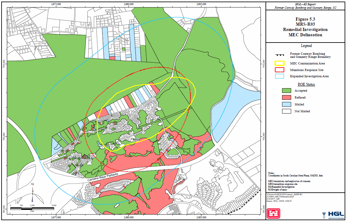
The “Contaminated Area” has been realigned as the top 3.5 feet of the 495 acres within the yellow circle in Figure 5.3.
This area includes the Single-Family Neighborhoods of Sweetbriar, Park Hill, Longbridge Tracts 2 & 3 (those north of the water tank), and all but the far south-western end of Brookstone and Oak Pointe. All other Barefoot Resort Properties are in the clear.
All developed lots and streets had been previously cleared by Centex, but adjoining areas (wetlands and buffers) were not.
The exposure risk to humans was determined to be unacceptable and has been recommended for further action to “address likelihood of exposure to construction workers, indoor/outdoor workers, maintenance/utility workers, trespassers, recreational users, and residents via direct contact” until a “negligible risk scenario is achieved”.
Many may have noticed the “Warning – Potential Unexploded Ordnance” signs along Watertower Road near Long Bay Road. Those signs are in the MRS-R04 site which was rated unacceptable in 2012.
I will report details from the future Feasibility Study when it is released. The RI report was 1.5 years behind schedule.
Until then, be careful in those wetlands and buffers.

